
state of kuwait
First of all, we would like to welcome you to the State of Kuwait, the Land of Friendship. Next is a brief introduction about Kuwait, the Land and the People.
The topography of Kuwait is typified by gently undulating desert gradually rising away from the sea to a maximum height of 200 meters. The mainland of Kuwait has no mountains or rivers. However, the flat sandy desert is broken by shallow depressions and low hills. All significant features in Kuwait are man-made.
The temperature averages 45°C (113°F) in summer and 10°C (50°F) in winter. The highest officially recorded temperature (in the shade) was 60°C (140°F) in July 1978, making Kuwait the fourth hottest place on earth, and the lowest was 6°C (43°F) in January 1964. Humidity is seldom uncomfortable. Annual rainfall is unpredictable.

isn't it strange, that the border between kuwait and its neighboring countries is visible from the air as the separation line between different shades of desert? it's actually a little bit off... notice also the pathetic stretch of alluvial plain that makes up iraq's entire coastline, squeezed between tigris and eufrates, between kuwait and iran... obviously part of the reasoning behind saddam's expansionist policies.
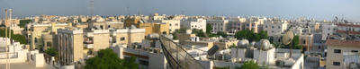
selwa, our 'neighborhood', seen from the roof of arabian villa
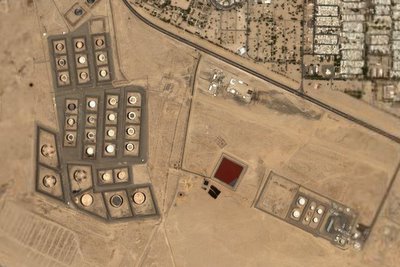
some of kuwait's man-made significant features look really intriguing from the sky. any ideas on what the red puddle could be?
an oil field with a settlement next to it, skirting the saudi border (yellow line). it is said that the kuwaitis were drilling obliquely (inclined) along the iraqi border. another reason for saddam to be upset.

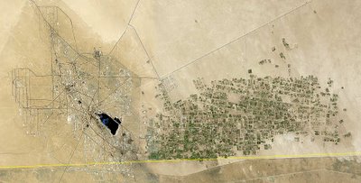
agricultural fields irrigated by a pivoting sprinkler, close to our site. this 'farm' is visible on the scale of the country.
The topography of Kuwait is typified by gently undulating desert gradually rising away from the sea to a maximum height of 200 meters. The mainland of Kuwait has no mountains or rivers. However, the flat sandy desert is broken by shallow depressions and low hills. All significant features in Kuwait are man-made.
The temperature averages 45°C (113°F) in summer and 10°C (50°F) in winter. The highest officially recorded temperature (in the shade) was 60°C (140°F) in July 1978, making Kuwait the fourth hottest place on earth, and the lowest was 6°C (43°F) in January 1964. Humidity is seldom uncomfortable. Annual rainfall is unpredictable.
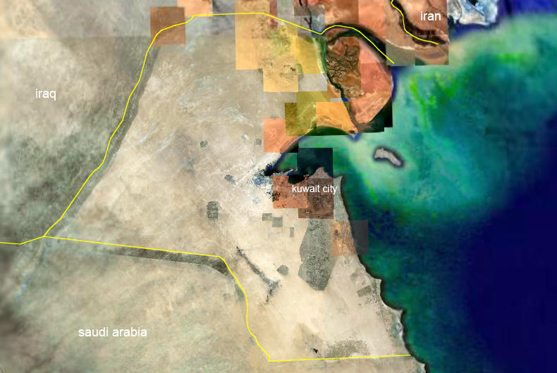
isn't it strange, that the border between kuwait and its neighboring countries is visible from the air as the separation line between different shades of desert? it's actually a little bit off... notice also the pathetic stretch of alluvial plain that makes up iraq's entire coastline, squeezed between tigris and eufrates, between kuwait and iran... obviously part of the reasoning behind saddam's expansionist policies.
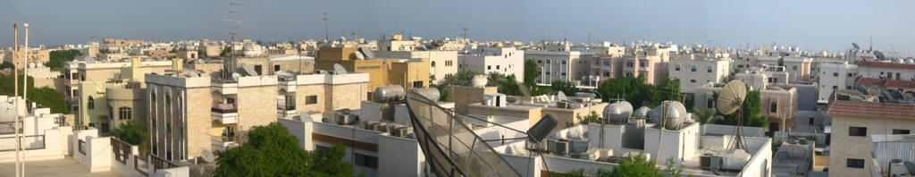
selwa, our 'neighborhood', seen from the roof of arabian villa
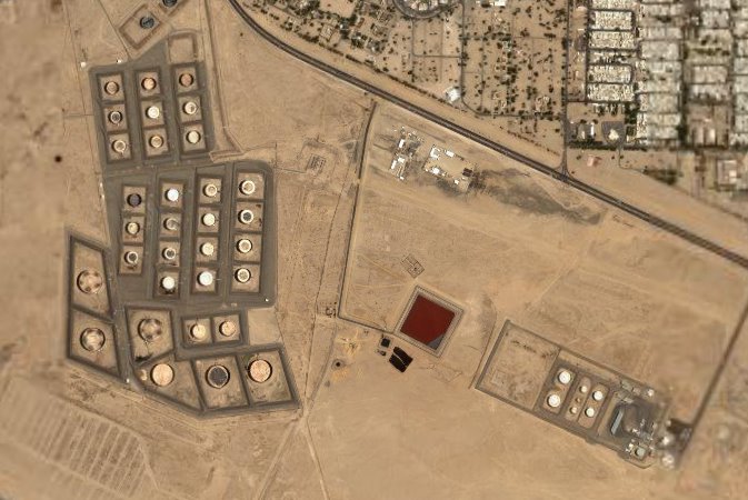
some of kuwait's man-made significant features look really intriguing from the sky. any ideas on what the red puddle could be?
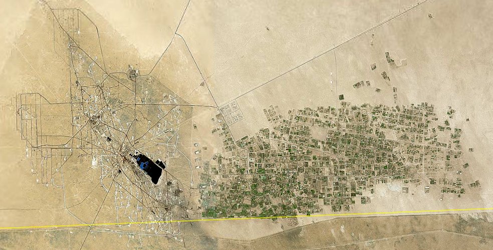
an oil field with a settlement next to it, skirting the saudi border (yellow line). it is said that the kuwaitis were drilling obliquely (inclined) along the iraqi border. another reason for saddam to be upset.
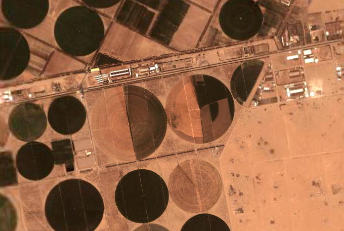
agricultural fields irrigated by a pivoting sprinkler, close to our site. this 'farm' is visible on the scale of the country.
posted by Jan at 11:25 AM
![]()


0 Comments:
Post a Comment